
Key Takeaways
- Seismic imaging technology helps the oil and gas industry answer one critical question. What is happening beneath the ground before we drill? By using seismic waves and turning them into 2D and 3D images, operators can reduce guesswork, plan smarter wells, and recover hydrocarbons more efficiently. With new tools like artificial intelligence, fiber optic sensing, and real-time monitoring, seismic imaging continues to be one of the most trusted ways to explore energy safely and responsibly.
Introduction
Teams must be sure of whatever is below before a drill hits the ground. Exploitation without knowledge of what is there beneath the surface can be costly, hazardous, and unsafe. The technology of seismic imaging is there to eliminate said uncertainty and to substitute it with an ability to see.
Through the movement of seismic waves, geoscientists are able to locate reservoirs, detect faults, and determine how robust or weak buildings underground may be. Although its major application is in oil and gas exploration, the same technology is also useful in environmental studies, mineral exploration, as well as earthquake research.
In this article, we discussion operation of seismic imaging, its importance, its evolution, and its future, and specifically on how it has assisted in the oil and gas industry.
What Is Seismic Imaging Technology?
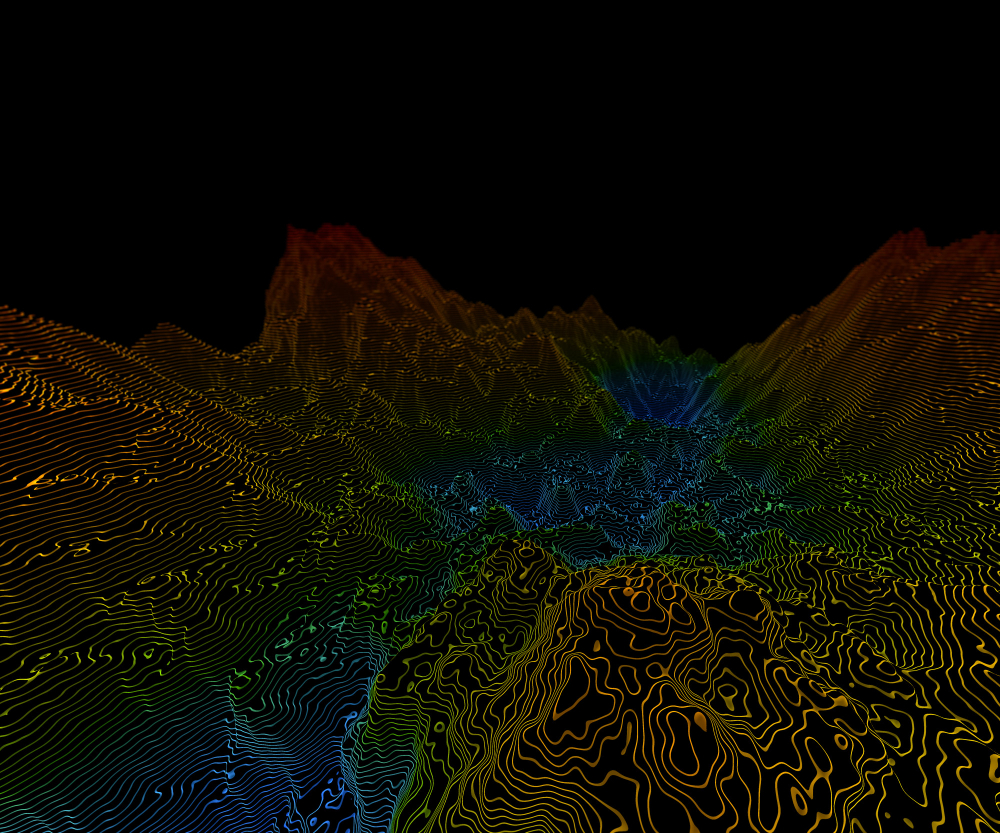
Seismic imaging technology uses artificially or naturally generated seismic waves to create a three dimensional representation of subsurface geological structures. These waves travel through the Earth, interact with different rock layers, and return information that helps scientists understand what lies below the surface before drilling begins.
Artificial sources:
Controlled explosions, vibroseis trucks, or specialized air guns generate seismic energy in a planned and controlled manner. These sources are commonly used in oil and gas exploration because they allow teams to design surveys with specific depth and coverage in mind. The controlled nature of these energy sources helps produce consistent data, making it easier to compare results across large survey areas and build reliable subsurface images.
Natural sources:
Earthquakes provide seismic waves for passive seismic studies and are often used in earthquake risk assessment. By recording naturally occurring seismic activity over time, scientists can study deep geological structures and regional tectonic behavior. While passive seismic methods are less common in hydrocarbon exploration, they are valuable for understanding large scale subsurface features and long term seismic patterns.
The returning waves are captured by sensitive sensors such as geophones, seismometers, or fiber optic cables. These instruments record small differences in wave speed, strength, and arrival time. By analyzing these variations, geophysicists can infer rock type, porosity, fluid content, and the presence of structural discontinuities like faults and fractures.
Seismic imaging is analogous to medical imaging such as MRI or CT scans but operates on a much larger scale. Instead of examining the human body, seismic imaging allows scientists to visualize rock formations that extend several kilometers below the Earth’s surface, offering a detailed view of areas that cannot be accessed directly.
Principles of Seismic Wave Propagation
The seismic imaging technology is based on seismic waves. In a seismic image, everything starts with the movement of these waves on the earth. The energy emitted goes off as waves and how the waves act out can tell us a lot about the materials they are going through. Seismic waves can further be categorized into two broad groupings depending on the direction and movement.
Body Waves
Body waves are the waves that travel through the interior of the earth and are the first signals picked in the case of a seismic survey.
P Waves (Primary waves):
P waves are compressional waves i.e. they travel as a result of squeezing and stretching the material through which they travel. They are seismic waves that travel at the fastest speed and are capable of traveling through solids, liquids, and gases. Due to this fact, P waves usually reach the seismic sensors first and are very instrumental in detecting fluid filled areas and predicting density of rocks.
S Waves (Secondary waves):
S waves travel perpendicular to the direction of travel in a motion that is side to side. They are only capable of traveling through solid materials unlike P waves. This is what limits them, and makes them particularly useful in getting an idea of rock strength and rigidity. When S waves slow or disappear, this may be a sign of fluids or more weak rock layers.
Surface Waves
Surface waves move around the surface of the earth as opposed to moving through the inside of the earth. Their movement is usually slower compared to that of body waves yet it is very powerful at the surface. Surface waves cause a lot of shaking on the ground and structural damage during earthquakes.
Surface waves have been treated as noise in seismic imaging in which they are filtered during data processing. They are however used to investigate shallow layers of the subsurface and near surface conditions in a few instances.
Seismic waves speed varies based on a number of factors which include rock composition, porosity, fluid saturation, temperature, and pressure. With proper measurements of how long it takes the waves to travel between the source and the receivers, geoscientists can estimate the speed of waves and utilize this estimate to construct finer models of the subsurface structures. These models are the foundation of certain interpretation and sound decision making in oil and gas exploration.
Techniques and Methodologies in Seismic Imaging
Reflection Seismic
Records waves reflected from interfaces between rock layers: When seismic waves encounter a boundary between two rock layers with different properties, part of the energy is reflected back to the surface. These reflected signals carry information about the depth and shape of subsurface layers, making it possible to visualize geological structures that cannot be seen directly.
Most common technique in oil and gas for reservoir detection and fault mapping: Reflection seismic is widely used because it provides clear and detailed images of subsurface formations. It helps identify potential hydrocarbon reservoirs, map faults, and understand layer continuity. This level of detail allows operators to reduce uncertainty before drilling and plan wells more accurately.
Refraction Seismic
Measures bending of waves as they pass through layers with varying velocities: As seismic waves travel through different rock layers, they bend when they move from one material to another with a different wave speed. By tracking these bent wave paths, geoscientists can estimate the depth and velocity of subsurface layers.
Useful for shallow studies and initial subsurface assessments: Refraction seismic is often used in early stage exploration or engineering studies where understanding shallow geology is important. It helps identify layer thickness, bedrock depth, and large scale subsurface features before more detailed surveys are conducted.
Seismic Tomography
Uses multiple seismic sources to generate 3D velocity models.
Seismic tomography combines data from many sources and receivers to create a three dimensional model of how seismic waves travel through the subsurface. This approach allows scientists to see variations in wave speed across different areas.
Provides detailed insight into complex structures, fractures, and fluid pathways.
Tomography is especially valuable in areas with complicated geology, where traditional imaging methods may struggle. It helps reveal fracture networks, fluid movement paths, and zones of weakness, supporting better reservoir management and risk assessment.
Advanced Data Acquisition and Processing
2D and 3D arrays:
Geophones or fiber optic sensors arranged in grids capture seismic data from multiple angles. This wide coverage improves image resolution and allows for a more accurate representation of subsurface structures.
Signal processing:
Techniques such as filtering, stacking, and migration are used to clean raw seismic data. These steps reduce noise, enhance meaningful signals, and sharpen subsurface images so that geological features can be interpreted with greater confidence.
Real-time interpretation:
Modern seismic software allows data to be analyzed almost immediately after it is recorded. This enables faster decision-making, helps teams adjust survey plans on the spot, and improves overall operational efficiency during exploration and production activities.
Applications in the Oil and Gas Industry
Reservoir Identification and Characterization
Seismic imaging technology enables operators to:
Find hydrocarbon-bearing formations:
Geoscientists can determine the rock layers which are most likely to have oil or gas after interpreting seismic reflections. This will assist in eliminating exploration focus and the expensive trial-and-error drilling.
Determine the size, shape and porosity of the reservoirs:
Seismic information gives information on the size of a particular reservoir, its shape and its fluids storage capacity. The knowledge of porosity and connectivity helps teams to figure out likely reserves and plan production with greater accuracy.
Optimise drilling paths and location of the well.
Having a clear image of the below surface, the engineers can create drilling paths, which are not dangerous, and access the most fruitful areas. This enhances the recovery rates and minimizes the time of drilling as well as costs of operation.
Fault and Fracture Mapping
Understanding fault lines and fracture networks is essential to:
Avoid drilling hazards.
During the drilling, faults and fractures may be very risky, such as loss of circulation and instability of the well. It is when these features are detected at the earliest stages with the assistance of seismic imaging, safe planning of wells becomes possible.
Enhance hydrocarbon recovery via targeted stimulation techniques. Fracture mapping also enables the operators to determine areas that can most benefit out of the stimulation methods. Through its targeting of natural fracture networks, the recovery can be enhanced without the unwarranted intervention.
Exploration and Production Optimization
The 3D and 4D seismic monitoring are used to monitor fluid movement that gives a clear picture of the reservoir whereas four dimensional seismic gives a picture of how reservoir responds to the production. This enables the teams to observe the movement of fluids and their reaction to extraction.
Reduces the risk of dry wells and improves production efficiency. Real-time adjustment of strategies can occur because the operators keep on updating the underground models. This makes it less likely that the company will drill unproductive wells and helps make smarter decisions on field development.
Environmental and Safety Applications
Monitoring subsurface for CO₂ storage and injection projects. The monitoring of the carbon storage locations is through the use of seismic imaging that is growing. It assists in ensuring that injected Co 2 is safely contained and it does not escape into unwanted spaces.
Mitigating risks associated with subsurface instability during drilling. Seismic data is used to avoid ground collapse, blowouts and other safety hazards by pinpointing weak areas or unstable structures, enabling safer operations
Historical Development of Seismic Imaging
1920s: Early refraction surveys marked the first use of seismic methods in oil exploration, offering basic insight into subsurface layering.
1950s: Reflection seismic transformed subsurface mapping by providing clearer images of geological structures at greater depths.
1980s: 3D seismic imaging became standard, allowing full volumetric analysis of reservoirs rather than simple cross sections.
2000s-Present: Advances in computing power, artificial intelligence, and distributed sensors have enabled faster processing, real time interpretation, and more accurate predictive models.
Challenges in Seismic Imaging
Complex geology: Wave interpretation is made complicated by complex geology that is folded, faulted, or salt rich. Seismic waves do not flow along straight paths in regions with complicated geological formations. They can also curve, diffuse or reflect, in unforeseen manners, and thus, making clear subsurface images more difficult. This makes the interpretation process more difficult and may need sophisticated processing methods and human skills.
Data quality: The accuracy can be compromised by noise caused by environmental factors and equipment constraints. Surface conditions like weather, terrain and human activity can influence seismic data. Unwanted noise can also be caused by equipment limitations or positioning the sensors. Once the data quality is lost, it is more difficult to determine if the geological signal is meaningful or this is the background interference.
Cost and scale: 3D surveys are very expensive financially and logistically when they are large. Large scale seismic survey is a time consuming process that requires specialized equipment, large scale planning as well as experienced personnel. It is the reason why seismic imaging is a big investment particularly in offshore or remote areas.
Emerging Solutions:
AI and machine learning for automated interpretation. Artificial intelligence aids in handling huge data sets in a short time and finding trends that is not easy to do manually. These tools assist in making decisions more quickly and enhance uniformity in different interpretations.
Distributed acoustic sensing (DAS) using fiber-optic networks for continuous monitoring that transforms fiber optic cables to dense mesh networks of sensors. This enables the continuous data acquisition of long distances and better real-time monitoring of the changes in the subsurface.
Integration with reservoir simulation and predictive analytics for enhanced exploration outcomes and will help the operators to know more about the behavior of reservoirs with time. This integration helps have better forecasts and better field development strategies.
Future Directions
AI-driven interpretation: Improves accuracy and reduces human error. Improves accuracy and reduces human error. As AI systems become more advanced, they will play a larger role in seismic interpretation. These tools can analyze complex datasets consistently, reduce subjective bias, and support geoscientists in making more reliable decisions.
Real-time 4D seismic imaging: Enables dynamic monitoring of reservoirs during production by allowing operators to observe changes in reservoirs as production progresses. This helps track fluid movement, identify bypassed zones, and adjust production strategies as conditions evolve.
Enhanced deep Earth imaging: Advances in sensors and computation may allow mapping of deeper mantle structures. Improved sensor sensitivity and increased computing power are expanding the depth range of seismic imaging. This could unlock new insights into deeper geological formations that were previously difficult to study.
Integration with IoT and digital twins: Provides a holistic view of reservoirs and drilling operations. By connecting seismic data with real time sensor inputs and digital twin models, operators can create dynamic representations of reservoirs. These models support better planning, risk management, and operational efficiency across the entire lifecycle of a project.
Conclusion
Seismic imaging technology remains one of the most powerful tools in the oil and gas industry. It helps teams see below the surface, make informed decisions, and operate more safely and efficiently. As the industry moves toward smarter and more sustainable energy practices, seismic imaging will continue to play a central role in understanding the Earth and unlocking its resources responsibly.
FAQs
What is seismic imaging technology in oil and gas?
It is a method that uses seismic waves to create detailed images of subsurface structures, guiding exploration and reservoir development.
How does seismic imaging detect oil and gas reservoirs?
By analyzing the reflection, refraction, and velocity of seismic waves, geophysicists can identify rock layers, porosity, and fluid content.
What are the main types of seismic surveys?
Reflection seismic, refraction seismic, and seismic tomography are the primary survey types used in exploration and reservoir characterization.
Why is 3D seismic imaging important?
It provides volumetric models of the subsurface, enabling precise well placement, fracture mapping, and reservoir management.
What advancements are shaping the future of seismic imaging?
AI-driven interpretation, distributed acoustic sensing (DAS), 4D real-time imaging, and integration with digital twin technology are key trends.

Comments